Current Views
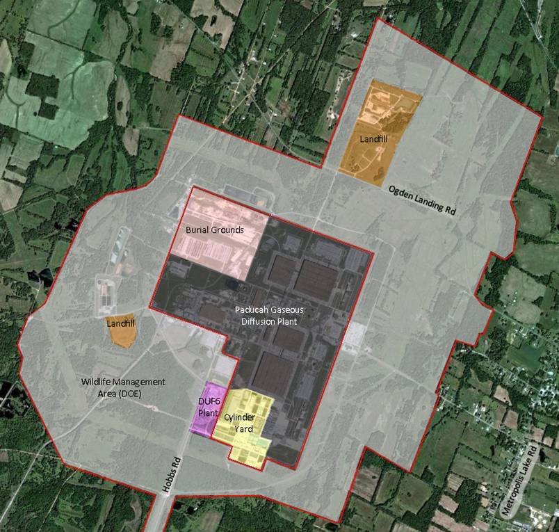
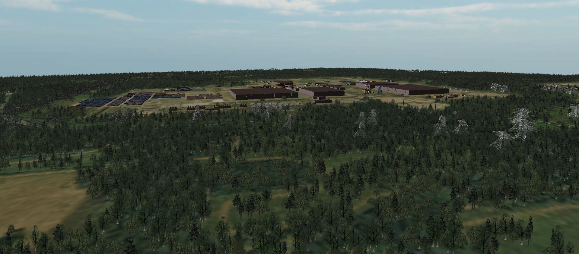
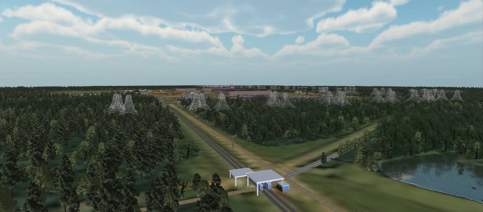
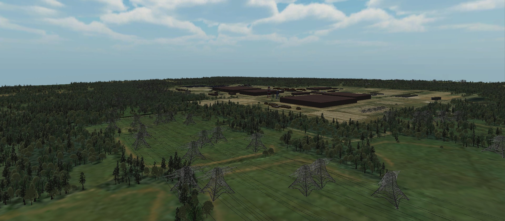
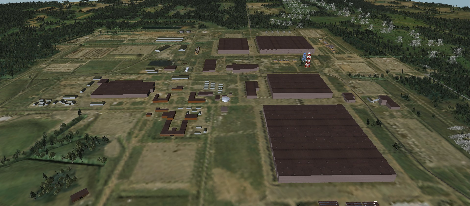
Here is a plan view of the existing plant and surrounding area. The inner red lines indicate the boundary of the PGDP plant, the outer boundary is of the surrounding Wildlife Management Area. Near the bottom, in purple, is a DUF6 plant that extracts fluorine from the existing depleted uranium fluoride (DUF6) stored in the yellow-coded Cylinder Yard. This plant is anticipated to operate for the next 20 years. Thus it will be part of all the future scenarios you see. The brown areas are specially designed landfills built to minimize seepage and runoff from the waste stored in them. They too, will remain where they are for the foreseeable future. The pink area contains many different burial pits containing a variety of plant waste, dating from the 1950’s onward. These sites were not designed to control seepage from the materials buried in them. They are just burial pits.
Now that you're a little more familiar with the basics of the existing plant site, the challenge is to think about what the future options are.
The following pages contain visual representations and textual descriptions of possible future scenarios for the PGDP site. They are intended to aid you in understanding and thinking about how suitable these various scenarios might be for you and your community. Ultimately, we will ask you and your neighbors to rate all of these future scenarios, anonymously, of course, so that we can better understand the preference of the community.
Each scenario contains different combinations of land uses and clean-up strategies for the site. For the existing PGDP plant site itself, there are six different types of land use portrayed:
- Nuclear power
- Heavy industry (for example a steel plant or auto manufacturing)
- Light industry/warehousing
- Recreational facilities (for example a fair grounds, soccer fields, etc)
- Wildlife management area (allows hunting, fishing, dog trials, etc)
- Controlled access/wildlife reserve (allows little or no human activity on the site)
At the same time, in the surrounding Wildlife Management Area, there are two land uses portrayed:
- Recreational facilities
- Wildlife management area
There are two choices for the existing Burial Pits:
- Leave them as is, where is
- Excavate them and find a means to dispose of the excavated materials
Finally, the actual plant building themselves will be torn down, and the demolition materials must be dealt with. There are three choices:
- Build a managed Waste Disposal Cell on site to contain ALL of the building materials
- Build a Waste Disposal Cell that contains SOME of the demolition materials, and ship the rest offsite to another, as yet unspecified location
- Do NOT build a Waste Disposal Cell onsite, and ship ALL of the demolition materials offsite to another, as yet unspecified location.
As we mentioned, the DUF-6 Fluoride Extraction plant will be in place, along with the cylinder yard it draws from, for at least 20 years, so it is present in all of the scenarios. You will notice that, in the cases where only SOME of the plant demolition materials are kept onsite, the height and size of the potential Waste Disposal Cell is proportionately smaller, and of course it is absent in scenarios where all the demolition and excavation waste is taken off site. The site of the Waste Disposal Cell is not necessarily fixed at the spot portrayed in the visualizations: it's location has yet to be determined, but this is one of the candidate sites. Also, the recreational facilities shown would not necessarily be located in exactly the spots indicated in the visualizations: their size and location can be modified to accommodate other needs on the site. Again, this is A possible location, but not the ONLY possible location.
As a moment's reflection will reveal, decisions about these different options are all linked together, and so we have prepared twelve different examples of how this site could be treated. Each scenario represents a different unique combination of the choices described above. There are even more possibilities than this, but in an effort to explore a range of diverse possibilities, we are beginning with these twelve. Your opinions about the suitability of each of these twelve scenarios will help us develop a better, clearer understanding of the needs and desires of the community.
These scenarios will be presented in public meetings in the next month or two in the Paducah area. At that time participants will be invited to score each and every scenario for its suitability as the future of the plant site, using anonymous, real-time scoring keypads. We will show the scoring results to the audience after each scenario is scored, and we'll ask you what makes each scenario more, or less, appealing. In this way, we hope to include as many people as possible in the process, in a way that makes sense to everyone, and in an efficient manner so that the meetings don't become excessively long. We hope that you can attend these meetings when they happen, so that we can count your opinion in.
Site Images